The Empire State Trail Connection: Bike Travel and Tourism from Hopewell Junction to Brewster, New York
The new Empire State Trail, proposed to connect more than 750 miles of bike and hike route through the state of New York, must get its act together in three years.
Because that’s when Governor Cuomo’s ambitious plan, announced last month (February 2017) and approved last week, is to be complete. And it lacks the meaty details. Where will it run? What will it connect?
This is the only map of the plan released so far:

Trail map (so far) for the Empire State Trail. Short on details, the map shows a conceptual route travelers and tourists could take through the state. The route links towns, villages, historic sites, natural scenic areas and already-built shared-use pathways.
The plan calls for a continuous off-road, shared-use pathway from New York City to Buffalo. The trail would stretch for 750 miles, the longest in the country.
But see that little section that leaves New York City at the southern end, and runs north into Westchester County, Putnam, Dutchess before crossing the Hudson River?
That section now runs along a few already-built, paved and bike-able trailways: the North County Trailway, South County Trailway, Old Put are a few (and they’re great). But there’s a piece missing: the twenty-two miles or so that would connect Brewster, New York, to Hopewell Junction.
This is a vital connection if a path is to hook up New York City bike travelers with the Dutchess Trail, and the trails west of the Hudson River.
Let’s Pave the Old Maybrook Line. It’s Ready.
Although I’m guessing, I think that, where the bike path dies in Brewster, New York, a continuation of the paved bike path will spring up in the next three years — because there’s a way to do it, and the way looks clear.
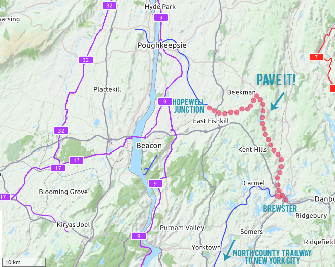
If the state paves the disused Maybrook train line from Brewster to Hopewell Junction, the twenty-two mile gap in the Empire State Trail can easily close.
That route would follow the old Maybrook line. The train service once took passengers from Brewster to Hopewell Junction and beyond. From Hopewell, It continued to Poughkeepsie. In Poughkeepsie, it traveled over what is now the Walkway Over the Hudson until 1974.
Now Metro-North owns the line. They bought it, but never really used it. So, Maybrook doesn’t carry trains much anymore:
Now, Metro-North uses the tracks to move equipment between its lines. It also has a trackage agreement with the Housatonic Railroad, a Connecticut freight railroad, though Metro-North says it is seldom used. — Journal News article, October 2016
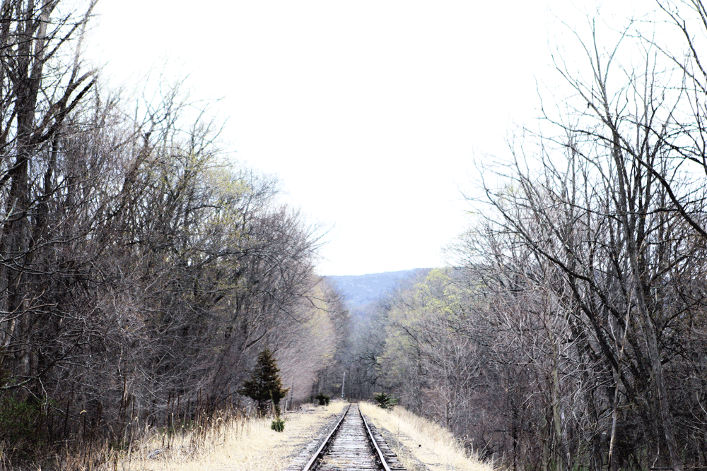
Recently, I visited the tracks. I wanted to see for myself where the Empire State Trail might go. Since the tracks haven’t been used in years, what kind of shape would they be in?
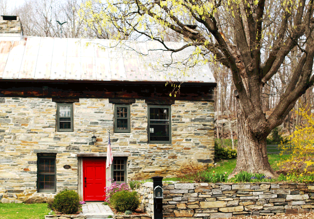
Stone house in Holmes, New York, in view of the (potential) route of the Empire State Trail, Putnam County.
The landscape of the area shimmers with grassy hills and forests, green pines lining paddocks. Everywhere, ponds, lakes and streams. But the tracks seemed to be holding up well, even in areas where they crossed roads to form one-lane tunnels.
Joining Little Hamlets and Places: Traveler and Tourist Heaven
But I love this about this route: It joins towns you’d probably never think of visiting. Have you ever heard of Holmes, New York? Or Whaley Lake?
More than anything, I’m drawn to the tiny, out-of-the-way hamlets strung out along these bike paths. “Sleepy” starts to describe it, but there’s something more.
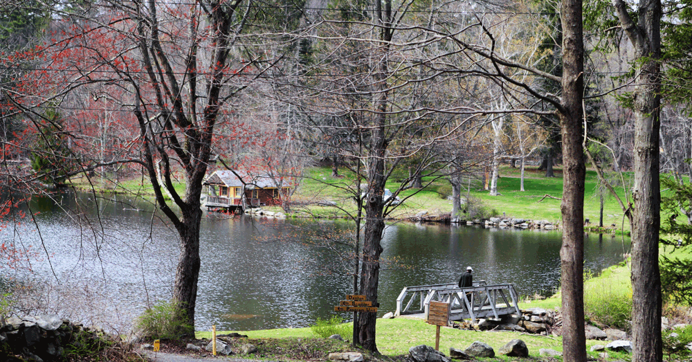
Denton Lake, along the Maywood line.
At Denton Lake on Thursday, I found men fishing in the afternoon, under pink trees that were just starting to leaf out. An old stone house stood on a state route corner. While a fire station advertised a fish-fry, jaunty old barns tilted in the grass.
Little summer camps ring Whaley Lake. The Maybrook section of the bike path would pass them on the opposite shore. In summer, I imagine, the lake community would be a good place to get a cone.
Through the trees, I could see a giant old trestle bridge. Rusted, but who knows what kind of shape it’s in for bikes to cross? Finally — with millions of dollars promised to the Hudson Valley Greenway — this could be just the place to spend it.
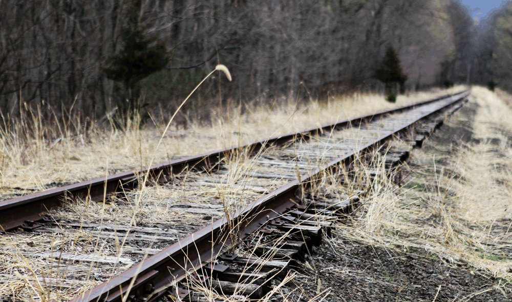
Section of track along the defunct Maywood line, just east of Hopewell Junction, New York.
I’m photographing towns, villages, hamlets and parks surrounding and connected by the proposed Empire State Trail this summer (2017). Drop me a line (please!) if you have a spot in mind, or if your trail town could make great promotional use of pictures.